

"When efficiency and precision matters"
www.africansurveyors.com
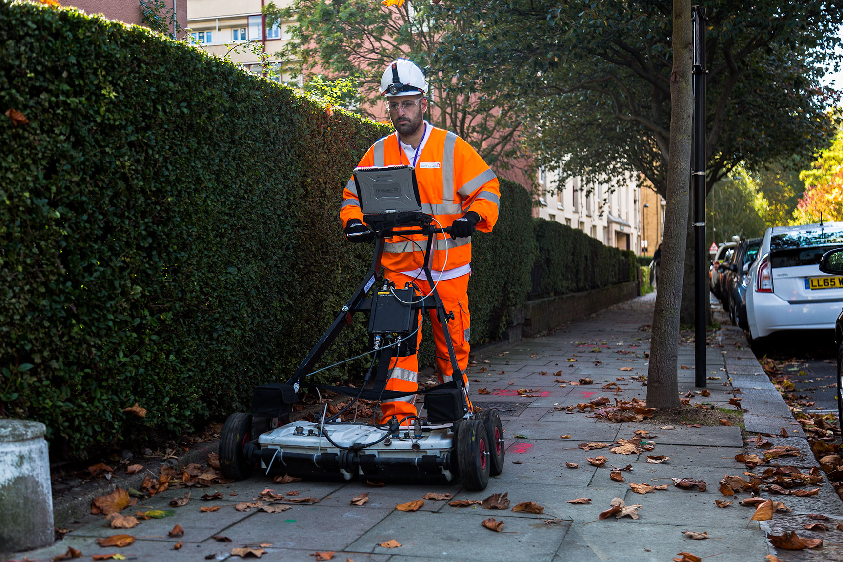
"The earth hides many things—but Ground Penetrating Radar helps reveal them."
This isn’t just poetic. It’s the foundation of GPR Surveys, a revolutionary technique that has transformed how engineers, architects, archaeologists, and developers explore what lies beneath. From mapping ancient ruins to preventing costly construction errors, GPR is now a vital tool across industries.
At African Consulting Surveyors, we’ve seen firsthand how the integration of GPR Surveys with other advanced technologies like Drone Surveys, Large Format Aerial Photography, and 3D Modelling creates unprecedented accuracy and project efficiency.
Let’s break down how this non-invasive method works, where it's best used, and why it should be part of your next Site survey.
GPR Surveys use electromagnetic radar pulses to "see" beneath the surface. These pulses are transmitted into the ground, and when they encounter a material with different electrical properties—such as a pipe, rock layer, or cavity—a portion of the energy reflects back. The GPR system captures this signal and displays it in real time, often forming hyperbolic patterns on the radargram that experts interpret into meaningful data.
The key to the method’s effectiveness lies in the interaction between radar waves and subsurface materials. The greater the contrast in dielectric permittivity, the clearer the return signal. That's why water content, soil composition, and material type all play major roles in survey results.
High-frequency antennas offer sharper resolution but limited depth penetration. Low-frequency antennas can probe deeper but produce less detail. At African Consulting Surveyors, we often tailor frequency ranges to match the goal—whether it's tracing buried infrastructure or imaging deeper geological layers.
One of the most common and critical applications of GPR Surveys is the detection of underground utilities—gas lines, electrical wiring, telecom cables, and water pipes. Whether metallic or non-metallic, GPR can detect them with high accuracy. This is particularly useful in pre-construction planning, where avoiding costly or dangerous utility strikes is paramount.
GPR doesn’t stop at utilities. It’s excellent at identifying hidden voids, sinkholes, buried tanks, and even unmarked graves. For construction and civil engineering firms, this offers an extra layer of risk management and planning intelligence.
When we’re called on for rebar mapping or concrete inspection, GPR is often the tool of choice. With high-frequency units, we can determine rebar spacing, slab thickness, and even locate post-tension cables—all without drilling or damaging the structure.
While GPR looks beneath the surface, Drone Surveys offer a rapid way to assess the terrain from above. By combining the two, we deliver complete spatial intelligence—both vertical and horizontal.
GPR data becomes even more powerful when placed within the broader geographic context. That’s where Large Format Aerial Photography comes in. By overlaying GPR findings onto high-resolution orthophotos, we give clients a visually intuitive view of underground features in relation to buildings, roads, or natural formations.
We often feed GPR datasets into 3D Modelling software. This produces digital twins of subsurface structures, which are used for simulation, planning, and presentation. Whether it’s a civil engineer reviewing pipe alignments or an archaeologist studying historical foundations, the clarity of a 3D subsurface model is unmatched.
GPR is primarily a land-based technique, but its use near water bodies can align closely with Hydrographic Surveys. For example, in areas where subsurface water features influence soil conditions or where construction meets shoreline, using both survey types gives you a holistic environmental understanding.
GPR Surveys are incredibly versatile, but they do have limitations. Highly conductive soils like clay or saline environments can attenuate the signal and reduce depth of penetration. In such cases, careful site selection and preliminary testing are essential.
Interpretation is also not plug-and-play. Skilled technicians are required to correctly read radargrams and distinguish real anomalies from noise or surface reflections. At African Consulting Surveyors, our team is trained to recognise these nuances and calibrate systems accordingly.
Time and cost savings alone make GPR an attractive option. Scanning a site before excavation can prevent missteps that delay timelines and inflate budgets. But beyond economics, there’s a safety component. GPR allows teams to avoid hazards, protect critical infrastructure, and proceed with confidence.
GPR Surveys also provide valuable documentation. The data can be archived, reanalyzed, or shared with other stakeholders long after the initial scan, forming a digital record of what's beneath.
As urban landscapes get denser and construction projects grow more complex, the value of GPR Surveys will only increase. The integration of AI, machine learning, and more advanced 3D visualization tools will push the limits of what we can do with radar data.
And with continued developments in multi-frequency antennas and software processing, we're stepping into an era where non-invasive scanning is not just a best practice—it's a standard.
At African Consulting Surveyors, we believe that precision begins below the surface. GPR Surveys give our clients a vital advantage—clarity in the unknown. Whether you’re breaking ground on a new development, preserving historical infrastructure, or simply making smarter engineering decisions, the data matters.
And it starts by looking beneath your feet.