
"When efficiency and precision matters"
www.africansurveyors.com
“Accuracy is the twin brother of honesty,” said Charles Simmons—and in the world of 3D scanning, nothing could be more true.
In construction, mining, and engineering, precision isn’t just a preference—it’s a necessity. When you're scanning a gold ore processing plant or capturing data for lidar room mapping, the margin for error must be microscopic. This is where positioning targets for 3D scanning become your greatest asset. These small but powerful tools are the secret behind aligning scans flawlessly, registering clean data, and producing models that are truly representative of real-world geometry.
At African Consulting Surveyors, we know that whether you're mapping infrastructure or modelling terrain, precision is power.
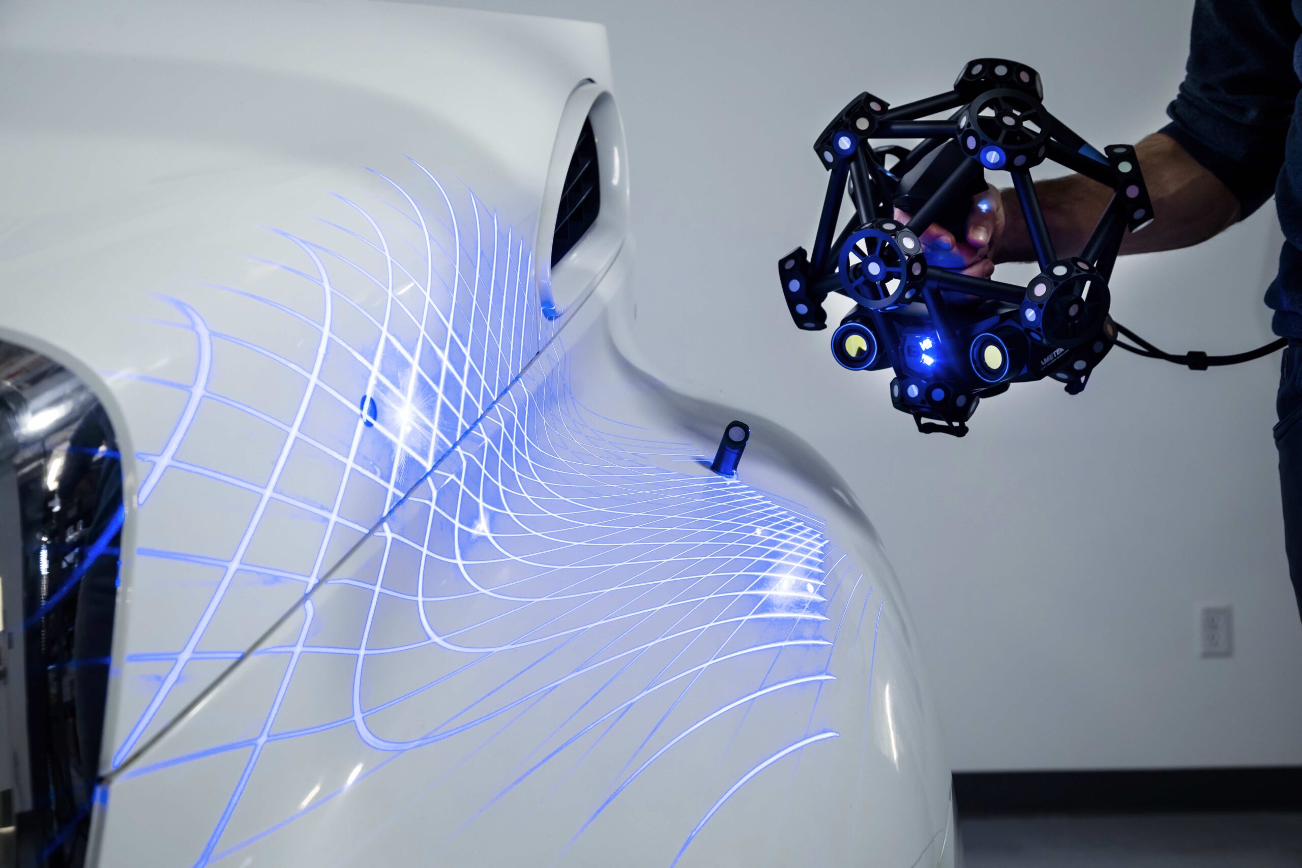
Positioning targets, also known as 3D scanner markers, are small, high-contrast reference points that a scanner uses to understand where it is and where it's been. They provide a fixed frame of reference—essential when scanning complex, symmetrical, or featureless surfaces that offer little natural guidance.
Whether you’re using a tripod-mounted laser scanner or a handheld unit moving around a large site, the scanner must maintain accurate spatial awareness. Without these markers, even the best scanners can drift off-course, misaligning point clouds and corrupting your entire model.
When capturing an object from multiple angles, you need to combine those scans seamlessly. Positioning targets for 3D scanning allow software to stitch these frames together automatically. Without them, you'd need to manually align features—time-consuming and often unreliable, especially with feature-poor surfaces.
Many industrial scanners require real-time tracking to maintain positional awareness. Positioning targets make this possible. They let the scanner understand its relative movement, ensuring your final model doesn’t suffer from drift or duplication errors.
This is particularly crucial in environments with minimal texture—like scanning the smooth internals of a processing tank or conducting lidar room mapping of an unfinished industrial shell.
The most common types of positioning targets include adhesive dots, magnetic markers, and retro-reflective stickers. Adhesive targets are versatile and easy to apply across a range of surfaces. Magnetic options are ideal for metallic environments—think heavy machinery or the structural framework of a gold ore processing plant. Retro-reflective markers, with their high visibility, are especially useful in low-light conditions or when you need reliable consistency across a large area.
The goal is to ensure the scanner can see at least three targets at any given time. This allows for triangulation and continuous movement tracking.
To get the most out of positioning targets, place them within the scanner's optimal field of view. Avoid clustering them or placing them at extreme angles that limit visibility. Clean the surface before applying the markers and always ensure they're flat and unobstructed.
For repetitive scanning workflows—like scanning hundreds of parts for quality control—consider using reusable target jigs, nets, or clusters. These save setup time and eliminate the margin for misplacement.
Some scanners use natural geometry and texture to track their movement. This works well when the scanned item has distinct features. But flat, symmetrical, or repeating surfaces—such as pipes, columns, or smooth tanks—can throw off the scanner completely.
In those cases, it’s essential to add artificial features like painter's tape, markers, or temporary geometry. Alternatively, rely on positioning targets to introduce those critical reference points.
Positioning targets are indispensable across various types of survey in civil engineering. They enhance accuracy during as-built documentation, infrastructure modelling, and even gold ore processing plant layout verification.
For professionals pursuing the objectives of surveying in civil engineering—like determining relative positions or monitoring structural movement—target-based scanning improves both the integrity and speed of your output.
From mapping archaeological sites to checking tolerances in industrial machinery, positioning targets remain at the heart of reliable 3D scanning.
A scan is only as good as its planning. At African Consulting Surveyors, we treat positioning targets for 3D scanning not as accessories, but as critical tools in delivering dependable, high-fidelity models.
So whether you're measuring deformation, aligning BIM data, or scanning the internal chambers of a gold ore processing plant, never underestimate the value of a few well-placed dots. Precision doesn’t just happen—it’s designed.