

"When efficiency and precision matters"
www.africansurveyors.com
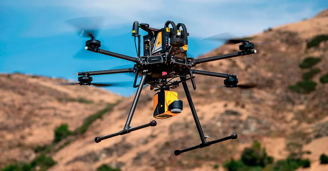
“The future is already here—it’s just not evenly distributed.” This quote by William Gibson perfectly encapsulates the transformative impact of LiDAR mapping drones in the fields of surveying, mapping, and 3D modeling. At African Consulting Surveyors (ACS), we are at the forefront of this revolution, leveraging cutting-edge technology to deliver unparalleled accuracy and efficiency in geospatial data collection.
LiDAR, or Light Detection and Ranging, is a remote sensing method that uses laser pulses to measure distances to the Earth's surface. When mounted on drones, LiDAR systems can rapidly collect high-resolution, three-dimensional information about the shape and surface characteristics of the terrain.
A LiDAR mapping drone emits laser pulses toward the ground as it flies over an area. These pulses bounce back upon hitting objects, and the time it takes for the pulses to return is measured to calculate distances. By combining this data with GPS and inertial measurement units (IMUs), the drone creates precise 3D models of the surveyed area.
In agriculture, LiDAR mapping drones are revolutionizing how farmers manage their land. By generating detailed topographic maps, these drones help in planning irrigation systems, assessing soil erosion, and optimizing planting strategies. This geospatial technology in agriculture leads to increased crop yields and sustainable farming practices.
For the energy sector, particularly in power plant processes, LiDAR-equipped drones offer a safer and more efficient means of inspecting infrastructure. They can access hard-to-reach areas, identify structural issues, and monitor equipment conditions without the need for manual inspections, thereby reducing downtime and maintenance costs.
Land surveyors benefit immensely from LiDAR mapping drones. These drones can quickly cover large areas, providing accurate topographic data essential for construction planning, land development, and legal documentation. The ability to penetrate vegetation and capture ground details makes them invaluable in diverse terrains.
In the realms of engineering and surveying, LiDAR mapping drones are indispensable. They facilitate the creation of detailed 3D models of construction sites, monitor structural changes over time, and assist in the design and planning of infrastructure projects. The precision and speed of data collection enhance project efficiency and accuracy.
Beyond traditional surveying, LiDAR mapping drones serve as powerful 3D scanning tools. They capture intricate details of buildings, landscapes, and other structures, enabling the creation of digital twins and virtual reality models. This capability is particularly beneficial in heritage conservation, urban planning, and disaster management.
At ACS, we pride ourselves on being leaders in the adoption and implementation of LiDAR mapping drone technology. Our team of experts utilizes this technology to deliver high-quality, accurate, and efficient surveying and mapping services across various sectors. By embracing innovation, we aim to provide our clients with solutions that meet the evolving demands of the modern world.
LiDAR mapping drones are transforming the landscape of surveying, mapping, and 3D modeling. Their ability to provide precise, high-resolution data quickly and safely makes them an invaluable asset across multiple industries. As technology continues to advance, the integration of LiDAR mapping drones will undoubtedly become even more integral to our understanding and management of the world around us.