
"When efficiency and precision matters"
www.africansurveyors.com
“One scan saved a crew from hitting a live cable beneath a meter of soil.” Accurate, fast, and safe. That’s the power of ground-penetrating radar. Today, GPR survey services are the silent heroes beneath our feet—mapping hidden utilities, supporting geological survey in civil engineering, and even complementing a Property Survey. Let’s dive in!
Ground-penetrating radar (GPR) is an electromagnetic wave tool used to scan beneath surfaces. GPR survey services emit pulses into the ground and record echoes. When pulses meet material interfaces like pipes or voids, a signal bounces back. The time and amplitude of that echo reveal depth and composition. It’s like ultrasound for the Earth—without the mess.
GPR survey services bring non-disruptive clarity to underground mysteries. They’re fast, deploying a single unit and expert to survey large areas in hours. Portability allows tight-space access—a boon for utility mapping. They detect metal and nonmetal objects, voids, soil changes, even structural decay in concrete. And they integrate with topographic maps, ensuring results fit into broader geospatial technology jobs.
High-frequency GPR tools (300–1500 MHz) excel at detailed mapping—perfect for inspecting floor slabs or concrete scanning. Lower frequencies (100–200 MHz) penetrate deeper—ideal for utility lines or coal preparation plant process studies. Understand your depth and resolution needs first, because depth and detail always trade off.
In civil engineering, GPR survey services support geological survey in civil engineering, bridging geophysical insight and construction reality. Imagine scanning a highway expansion site: GPR reveals voids, hidden conduits, or subsurface surprises before the bulldozer rolls. For construction, this is crucial. And with benefits of 3d scanning, these surveys complement as-built models and digital twins, making healthy workflows!
A thorough Property Survey should consider unseen aspects: live cables, septic tanks, shallow foundations. GPR survey services integrate smoothly into surveying packages, adding another layer of risk reduction. When you commission a surveyor, insist on GPR-inclusive reports—especially in older or high-risk sites.
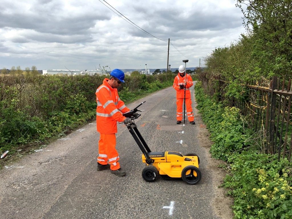
A GPR setup includes a transmitter, receiver, and data encoder—mounted on carts or handheld. Frequency choice tailors performance. Surveyors sweep the target area along grids. Real-time software displays depth-sliced scans. Afterward, trained analysts interpret anomalies: hyperbolas for pipes, flat layers for cracks. The result is a mapped stratigraphy, ready for site plans or engineering decisions.
In dense cities, mapping undocumented pipes or cables is critical. GPR survey services chart these elements pre-dig, avoiding costly damage and downtime.
Bridges, roads, tunnels—GPR can detect voids or delamination. It’s non-destructive and perfect for routine health-monitoring.
Within coal preparation plant process areas, GPR helps map underground structures, ensuring foundation integrity and avoiding interference with buried infrastructure.
Select a service with qualified technicians, appropriate frequency tools, and integrated geo-mapping systems. Ask for samples of previous surveys. Verify their data processing workflow—do they provide depth-calibrated outputs and interpretive reports? A provider that bridges GPR with geospatial technology jobs is your best bet.
Clear the area of debris, mark boundaries, and surface-clean to improve signal penetration. Coordinate with topographers to overlay visual layers. During the survey, stay nearby—real-time scans may surface questions mid-sweep.
GPR struggles in high-conductivity soils—like wet clay or salt-rich sands—which attenuate signals. In such cases, combine GPR with electromagnetic or resistivity surveys. And remember—to detect closely spaced utilities, avoid overlying layers that obscure deeper targets.
GPR survey services are an indispensable tool in modern subsurface exploration. They elevate civil engineering insights, enrich property surveys, safeguard infrastructure, boost benefits of 3d scanning, and even support mineral-focused industries. For anyone involved in construction, utilities, or site preparation, they’re not optional—they’re essential. Let’s keep digging smart.
If you’d like help integrating GPR survey services into your next project, African Consulting Surveyors is here to guide you—see us in action!