
"When efficiency and precision matters"
www.africansurveyors.com
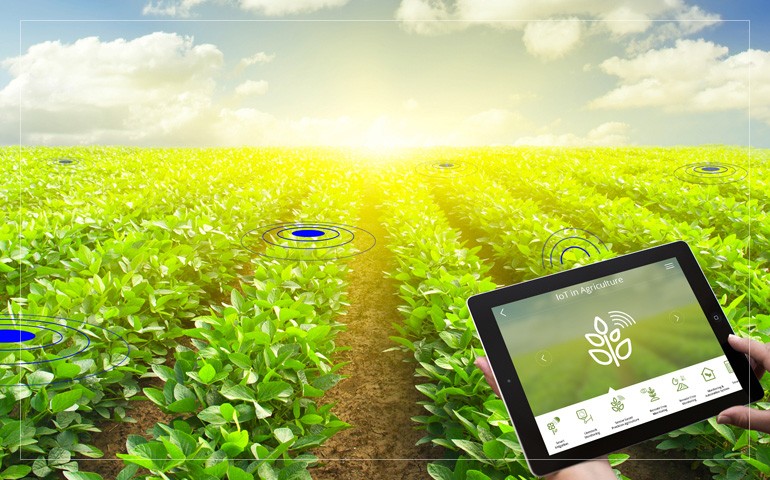
“Precision agriculture is not just a buzzword—it’s the backbone of modern farming.” As global food demand rises and climate unpredictability intensifies, farmers are turning to geospatial technology in agriculture to boost productivity, reduce waste, and make smarter decisions. At African Consulting Surveyors, we’re witnessing firsthand how these technologies are transforming fields into data-rich ecosystems.
Geospatial technology in agriculture combines tools like Geographic Information Systems (GIS), Global Positioning Systems (GPS), and remote sensing to collect, analyze, and visualize spatial data. This integration allows farmers to monitor crop health, soil conditions, and weather patterns with unprecedented precision. By leveraging these insights, agricultural practices become more efficient and sustainable.
Precision agriculture utilizes geospatial data to manage variations in the field, ensuring that crops receive the right amount of inputs at the right time. This approach leads to optimized yields and resource conservation. For instance, by analyzing soil moisture levels and nutrient content, farmers can tailor irrigation and fertilization schedules, reducing waste and enhancing crop performance.
Remote sensing technologies, including satellites and drones, provide high-resolution imagery that helps in monitoring crop growth and detecting issues like pest infestations or nutrient deficiencies early on. Drones equipped with multispectral sensors can capture detailed images, enabling farmers to assess plant health and make informed decisions swiftly.
LiDAR mapping drones and 3D scanning tools offer detailed topographical data, allowing for precise field mapping and terrain analysis. This information is crucial for planning irrigation systems, managing erosion, and optimizing planting strategies. By understanding the landscape's nuances, farmers can implement practices that align with the land's natural contours, enhancing productivity and sustainability.
GIS technology enables the layering of various data sets—such as soil type, crop yield, and weather patterns—onto a single map. This holistic view aids in strategic planning and decision-making. For example, identifying areas of a field that consistently underperform can prompt targeted interventions, improving overall farm efficiency.
Understanding the power plant process is essential for modern agriculture, especially when integrating renewable energy sources into farming operations. Geospatial technology assists in site selection for solar panels or wind turbines by analyzing factors like sunlight exposure and wind patterns. This synergy between agriculture and energy promotes sustainability and reduces operational costs.
Accurate geospatial data collection and interpretation hinge on the expertise of land surveyors. These professionals play a pivotal role in mapping fields, setting up GPS-guided equipment, and ensuring that data-driven decisions are based on precise measurements. Their work underpins the successful implementation of geospatial technologies in agriculture.
The integration of geospatial technology in agriculture marks a significant leap toward sustainable and efficient food production. By harnessing tools like GIS, remote sensing, LiDAR, and 3D scanning, farmers can make informed decisions that enhance productivity and environmental stewardship. As we continue to innovate and adopt these technologies, the future of farming looks promising, with the potential to meet global food demands while preserving our planet's resources.