

"When efficiency and precision matters"
www.africansurveyors.com
A recent study showed 3D scanning accuracy has improved by over 60% in just the past decade—and that change is shaking up engineering worldwide.
3d scanning engineering combines laser or structured‑light tech with software to capture real‑world geometry down to fractions of a millimeter. It’s more than fancy gadgets—it’s about transforming physical objects into digital replicas faithfully. Engineers, architects and surveyors embrace this to ensure accuracy on complex projects. At African Consulting Surveyors, we’ve seen how it revolutionizes accuracy—from construction sites to high‑tech process plant technology.
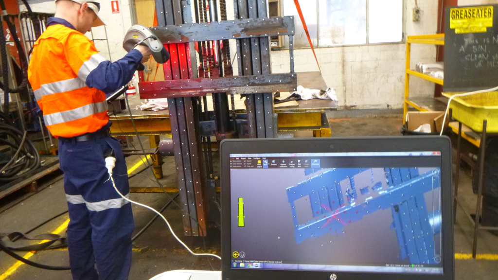
First, we clean and prep surfaces meticulously. Dust or glare can ruin a scan. We also position high‑contrast positioning targets for 3d scanning engineering to anchor the scan’s coordinate system, improving alignment across multiple passes.
Using laser beams, scanners sweep objects—buildings, mechanical parts, even entire rooms—capturing millions of data points. This raw “point cloud” forms the basis of everything that follows.
Next, data is refined: holes are filled, noise is removed and points are stitched into meshes. We convert these meshes into CAD-ready formats for reverse engineering or BIM workflows. I love this stage because the transformation is stunning!
When original design files are missing, 3D scans recreate parts accurately and quickly. Reverse engineering with scanning is invaluable in manufacturing and heritage restoration alike.
As‑built scans are compared against design models so discrepancies are caught early. For example, we overlay scans during 3d modelling in construction to uncover misalignments before they snowball into costly rework.
Integrating 3d scanning engineering with geospatial technology and the role of location in science, we produce spatially accurate models that inform environmental planning, terrain analysis, and urban design. We even integrate data with online lidar maps to visualize terrain context seamlessly.
In industrial plants, scanning provides accurate as‑built documentation for retrofit and optimization. Engineers can spot misalignments in pipe runs and equipment placements, saving both downtime and risk during upgrades.
When combined with lidar services—like airborne or tripod-based scans—we expand situational awareness, merging terrain, building, and interior data into one coherent spatial model.
We feed processed scans into BIM platforms. This enables clash detection, accurate quantities, and model-led planning. It’s powerful stuff that drives coordination on large-scale projects.
Good positioning targets for 3d scanning are worth their weight in gold. They provide reference points that boost registration accuracy.
Every scan must overlap at least 20%. I always say: shoot slowly and generously. Overlap ensures seamless stitching and reliable geometry.
Tripod stability and vibration control are essential. A shaky scanner introduces noise that’s hard to correct later.
Expect smarter scanners with embedded AI to auto-clean noise in real time. Integration with process plant technology will deepen with digital twins monitoring operations. Online lidar maps will evolve into live, collaborative platforms in smart cities. And who knows—portable scanners may become as ubiquitous as smartphones!